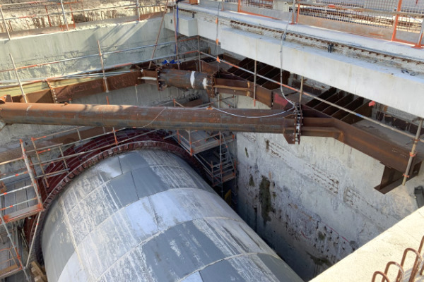
The Forrestfield-Airport Link (FAL) project will deliver an 8.5 km extension of the existing PTA urban rail network in Perth, Western Australia connecting the Midland Line, just past Bayswater Station, to Forrestfield, running underground in twin bored tunnels underneath the Swan River, Tonkin Highway and Perth Airport.
The project will include three new stations, being: Redcliffe Station (located underground in Redcliffe), Airport Central Station (located underground at Perth Airport to service both domestic and international terminals) and Forrestfield Station.
The project will provide new rail services allowing a 20-minute rail journey from Forrestfield Station to the Perth CBD, improved bus networks for the eastern suburbs, foothills and surrounding communities as well as integration with the full Transperth bus and train network.
Redcliffe Station and Forrestfield Station will have rail-bus interchanges and up to 2,500 new car parking bays in total.
Description of Geomotion Works
Geomotion was part of a consortium that was awarded works by the SI-NRW JV and was broadly responsible for the followings works:
- Drilling (through subcontractor) & Installations, maintenance and monitoring of Geotechnical Instruments as per Project Instrumentation and Monitoring Plan (IMP). The monitoring system incorporates installation of Inclinometer tubing with spider magnets/ magnetic ring for DEX system including in-place inclinometers, single and multipoint rod extensometers & displacement transducer, Heave Stake, Piezometers (Vibrating wire, vented pressure transducer with conventional sand filter), Strain Gauges (surface, tunnel segment & strut), Strut Load Cells, Biaxial Tilt meter, Electro level Beam, Vibrometer and Structure Monitoring Prism inside tunnel for convergence monitoring.
- Installation of data loggers (miniOmnialog, Omnialog, Loadsensing, Syscom) with telemetry for automation for instruments required near real time measurements.
- Set up & Maintenance of Web based Monitoring Information & Management System (MIMS) using Maxwell Geosystems Mission OS construction data management package. All sensors are either connected to data logging system and is linked to MIMS with telemetry or manual survey data processed & uploaded on MIMS. The software allows direct comparison between monitored and designed behaviour including automated reporting.
System Installations
- 39 In-Place Inclinometer (Including DEX-S)
- 38 Single Point Rod Extensometer with Displacement Sensors
- 34 Multi Point Rod Extensometer with Displacement Sensors
- 9 Biaxial Tilt Meters
- 8 Strain Gauges (Surface)
- 288 Strain Gauges (Tunnel Segment)
- 15 Strain Gauges (Spot Weldable- Strut)
- 7 Load Cell (Strut)
- 518 m Diaphragm Wall Inclinometer Tubing
- 958 m Soil Inclinometer Tubing
- 73 Vibrating Wire Piezometer
- 5 Vented Pressure Transducer
- 2 Electro level Beam
- 2 Heave Stake
- 9 Vibrometer
- 114 Structure Monitoring Prism (Tunnel)
Contact us to discuss about your infrastructure project.